
On behalf of the Western Inter-County Railway Committee, comprising cross-party representatives from the six County Councils of Connacht and Clare, we wish to express our strong support for the Rail...
06. Movement & Transport
Closed23 Dec, 2020, 9:00am - 16 Mar, 2021, 4:00pm
6.1 Strategic Aim
The strategic aim of this chapter is to support increased use of sustainable modes of transport; the integration of spatial planning with transport planning; enhanced county and regional accessibility; the transition to a low carbon energy efficient transport system; and the development of a safer, more efficient, effective and connected transport system within Mayo.
Related UN Sustainable Development Goals

Related NPF National Strategic Outcomes
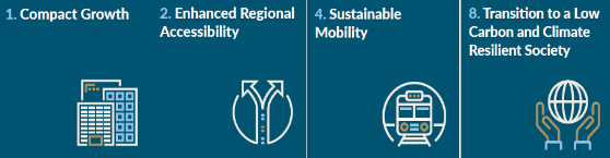
Related RSES Regional Growth Ambitions
6.2 Introduction
This chapter has been guided by the above strategic aim, sustainable development goals and national strategic objectives to support the transition to a low carbon future, through use of sustainable modes of transport in County Mayo. The chapter has also considered the key legislative and policy documents set out in Appendix III, including the NPF and RSES for the Northern and Western region.
6.3 National and Regional Planning Position
A core objective of the NPF and RSES is the need for more sustainable forms of transport to reduce energy demand and greenhouse gas emissions, such as walking, cycling, electric vehicles and the increased usage of public transport. Sustainable mobility can be realised through the effective integration of land-use and transportation; the design of roads and streets; using more sustainable modes of transport; providing supporting infrastructure and education. The RSES requires the preparation of Local Transport Plans (LTP) to be made for the Key Towns of Ballina and Castlebar. These plans will support the National Planning Framework objectives of Compact Growth and Sustainable Mobility.
The NPF and RSES also places a strong emphasis on enhanced regional accessibility. The growth of the northern and western region is dependent on transport and infrastructure investment, in order to improve accessibility and travel times between urban and rural settlements. The RSES recognises the strategic importance of the Western Rail Corridor (WRC) as a growth enabler for the region, and its potential to link the economies of large urban centres along the western seaboard. The strategy also recognises the potential of the WRC in consolidating the Atlantic Economic Corridor (AEC). The importance of Ireland West Airport Knock (IWAK) is also recognised by the NPF and RSES as having a very significant role in tourism and enterprise development for the region.
6.4 Mayo Context
The provision of high-quality transport infrastructure and protection of the existing extensive transport network in County Mayo is critical to the county’s socio-economic development and will ensure quality levels of service, accessibility and connectivity to transport users. Mayo is strategically located along the AEC and along on the western seaboard, with an international airport, railway and high quality national, regional and local road networks. The county has a significant advantage within the north-west region, in terms of its location and economic assets. These advantages must be progressed in tandem with the sustainable management and development of other essential infrastructure, whilst having regard to environmental responsibilities and complying with European and national legislation. A priority of this plan is the enhancement of the existing physical infrastructure network within the county and to strive to transition to a low carbon future, through greater support and promotion of more sustainable modes of transport.
6.4.1 Sustainable Transport
An effective and multi-modal transport system is reliant on the successful integration with land use planning. This will ensure the efficient use of land to deliver compact growth, create vibrant towns and villages and the transition to a low carbon, climate friendly environment. The location and design of development has a fundamental influence on travel patterns. This plan seeks to encourage walking and cycling as the primary modes of transports within settlement communities.
Improved street design in settlements will encourage more people to choose to walk, cycle or use public transport, by making the experience safer and more pleasant. It will help lower traffic speeds, reduce unnecessary car use and create a built environment that promotes healthy lifestyles and responds more sympathetically to the distinctive nature of individual communities and places. The Design Manual for Urban Roads and Streets (DMURS) provides design guidance and standards for constructing new and reconfiguring existing urban roads and streets in Ireland, to ensure they are safe for pedestrians and cyclists. This plan recognises that the continued delivery and maintenance of a well-functioning, multi-modal transport network is essential to advance the county’s economic competitiveness, improve quality of life and enhance social cohesion.
6.4.1.1 Integrated Land Use and Transportation
The integration of land use and transportation is a fundamental principle of the national policy document Smarter Travel: A Sustainable Transport Future, 2009 - 2020. By shaping the pattern of development and influencing the location, scale, density, design and mix of land-uses, the integration of land-use and transportation can help reduce the need to travel and facilitate sustainable urban development.
The plan promotes an integrated approach to land-use and transportation which aligns with the Core Strategy and directs future development into existing towns and settlements within County Mayo, in order to reduce car dependency. The plan strongly supports the creation of compact growth, consolidation of existing settlements and prioritisation of the development of brownfield lands across the settlement hierarchy, which in turn will encourage the use of public transport, cycling and walking as viable alternatives to the private car. Lands identified for residential development in the Settlement Plans maps (Volume 3) are located within the built-up area and are generally situated close to or within the core areas of the settlements, in order to encourage the consolidation of the settlements and make active travel (walking and cycling) more viable. Local Transport Plans are required to be prepared for Castlebar, Ballina and Westport under the RSES. The council, however, will support the preparation of similar sustainable transport plans for other settlements in the county, commensurate to the size and function of the settlement, to encourage sustainable transport.
Integrated Land Use and Transportation Policies |
|
|
MTP 1
|
To support sustainable travel in the county by ensuring future population and employment growth predominantly takes place in urban areas which will warrant provision of public transport services. |
|
MTP 2
|
To support and facilitate the integration of land use with transportation infrastructure, through the development of sustainable compact settlements which are well served by public transport. |
|
MTP 3
|
To support and facilitate any ‘Smarter Travel’ initiatives that will improve sustainable transportation within the county, including public transport, electric and hybrid vehicles, car clubs, public bike schemes, improved pedestrian and cycling facilities, as appropriate. |
Integrated Land Use and Transportation Objective |
|
|
MTO 1
|
To prepare and commence implementation of, Local Transport Plans (LTP), in conjunction with the National Transport Authority and relevant stakeholders, for Ballina, Castlebar and Westport, and other settlements, where appropriate. |
6.4.1.2 Sustainable Mobility
Sustainable mobility can be described as linking people and places in a sustainable way by supporting:
- Comfortable and affordable journeys to and from work, home, school, college, shops and leisure;
- Travel by cleaner and greener transport; and
- A shift away from the private car to greater use of active travel (walking and cycling) and public transport (e.g. bus and rail).
Sustainable mobility is a challenge for County Mayo, which has one of the highest usage rates of private cars (73.2%), compared to the national average (65.6%). The dominance of the private car as the primary mode of transport is mainly contributed to the fact that Mayo is predominantly a rural county, with 71.4% of the population living in the rural area, compared to 37.3% nationally. The county has a dispersed settlement pattern and a low population density of 23.3 people per sq. km, compared to the national average (70 people per sq. km). Furthermore, the lack of viable alternative sustainable modes of transport is also a significant contributing factor for the high usage of private cars in the county. Less than 1% of commuters in Mayo use public transport, compared to the national average of 9.3%.
Achieving sustainable mobility will require working with key stakeholders, including the National Transport Authority and through a suite of actions which involves:
- Focusing targeted population and employment growth in settlement areas;
- Providing alternative options to the car, namely, walking, cycling and public transport;
- Improving fuel efficiency, promoting energy efficient driving and alternative technologies; and
- Permeability and accessibility improvements.
Settlement patterns play a fundamental role in influencing how people travel, both the distances undertaken and the modal choice. The provision of sustainable mobility options is only realistic when development patterns locate populations close to employment centres and complementary services such as education, retail and leisure. Walking and cycling become increasingly viable as transport options when the distance between such services is reduced. There is a need to ensure that alternatives to the car are integrated in the design of streets and public spaces, prioritising cycling and walking as active transport modes. The effective management of space in town and village centres should deliver a high level of priority and permeability for walking and cycling to create accessible, attractive, vibrant and safe places to work, live, shop and engage in community life.
Existing Modes of Transport
Table 6.1 below provides a breakdown of the daytime population (i.e. residents and commuters) in Tier I and Tier II settlements. These figures account for persons who worked or studied in the area, along with persons who travel to these towns for other purposes. The table shows that the daytime population more than doubles in most towns during the day. Workplace zones are available for each settlement.
|
Settlements |
Sum of Total Workers in Workplace Zone |
Sum of Total Daytime Population in Workplace Zone |
|
TIER I |
|
|
|
Ballina |
5459 |
11821 |
|
Castlebar |
8851 |
16211 |
|
Westport |
4210 |
8347 |
|
TIER II |
|
|
|
Ballinrobe |
1506 |
4082 |
|
Béal an Mhuirthead (Belmullet) |
494 |
966 |
|
Ballyhaunis |
1484 |
3485 |
|
Claremorris |
1667 |
3509 |
|
Swinford |
1096 |
2574 |
Table 6.1: Daytime population in Tier I and Tier II settlements, Census 2016
Tables 6.2 and 6.3 provide a breakdown of the modes of travel for the daytime population for Tier I and Tier II towns (POWSCAR). The tables show that the private car is the main mode of transport in Tier I (55%) and Tier II (51%) towns, which is below the national average (61.40%). Béal an Mhuirthead (Belmullet) is the only settlement where private car usage is higher (79%) than the national average. This is attributed to its location in the north-west of the county, which serves a wide hinterland in comparison to the other settlements. It is also apparent that car passenger (car sharing) is well above the national average in all settlements, which would indicate that car sharing is a viable option. Cycling, motorbike/scooters and rail transport in all settlements is below the national average, whereas bus transport usage is above the national average for five settlements. In the short term, the modal shift strategy should focus on increased usage of cycling for all settlements.
|
Mode of Travel |
Castlebar |
Ballina |
Westport |
Tier 1 Combined Average |
National CSO 2016 |
|
Car Driver |
59.35% |
53.80% |
50.56% |
54.57% |
61.40% |
|
Car Passenger |
17.91% |
18.43% |
19.26% |
18.53% |
4.10% |
|
Bus |
3.77% |
4.10% |
7.85% |
5.24% |
5.90% |
|
Train |
0.08% |
0% |
0.65% |
0.24% |
3.40% |
|
Walk |
11.58% |
13.18% |
13.86% |
12.87% |
9.30% |
|
Bicycle |
0.73% |
1.03% |
1.21% |
0.99% |
3.00% |
|
Motorbike/Scooter |
0.14% |
0.14% |
0.16% |
0.15% |
0.40% |
|
Other (incl. lorry/van) |
4.56% |
6.61% |
5.82% |
5.66% |
7.30% |
|
Not Stated |
2.42% |
3.20% |
2.19% |
2.42% |
5.00% |
Table 6.2 – Tier I Towns & National Mode of Travel, Census 2016
|
Mode of Travel |
Ballinrobe |
Ballyhaunis |
Béal an Mhuirthead (Belmullet) |
Claremorris |
Swinford |
Tier 2 Combined Average |
National CSO 2016 |
|
Car Driver |
35.88% |
40.88% |
79.14% |
47.29% |
49.94% |
50.63% |
61.40% |
|
Car Passenger |
26.38% |
23.04% |
23.52% |
22.13% |
23.79% |
23.77% |
4.10% |
|
Bus |
11.57% |
9.33% |
0.59% |
9.33% |
8.47% |
7.86% |
5.90% |
|
Train |
0.34% |
0.42% |
0.00% |
0.16% |
0.06% |
0.18% |
3.40% |
|
Walk |
12.79% |
15.71% |
10.95% |
12.07% |
8.53% |
12.01% |
9.30% |
|
Bicycle |
0.81% |
0.64% |
0.44% |
0.93% |
0.35% |
0.63% |
3.00% |
|
Motorbike/ Scooter |
0.15% |
0.17% |
0.00% |
0.16% |
0.06% |
0.11% |
0.40% |
|
Other (incl. lorry/van) |
2.96% |
1.57% |
1.77% |
1.53% |
1.64% |
1.89% |
7.30% |
|
Not Stated |
2.22% |
3.83% |
3.84% |
1.05% |
3.10% |
2.81% |
5.00% |
Table 6.3 Tier II Towns & National Mode of Travel, Census 2016
Sustainable Mobility Policies |
|
|
MTP 4
|
To support sustainable mobility, enhanced regional accessibility and connectivity within County Mayo in accordance with the National Strategic Outcomes of Project 2040 and the Regional Spatial and Economic Strategy for the Northern and Western Region. |
|
MTP 5
|
To promote the transition to a low carbon integrated transport system by firstly reducing the need for travel through the use of design solutions and innovative approaches with regards to the Design Manual for Urban Roads and Streets, and subsequently to shift to environmentally sustainable modes of transport. |
Sustainable Mobility Objectives |
|
|
MTO 2
|
To ensure that planning applications for large scale developments, that are significant trip intensive generators are accompanied by a Mobility Management Plan. |
|
MTO 3
|
To liaise and collaborate with relevant agencies to support and encourage the growth of electric vehicles and EBikes with support facilities/infrastructure through a roll-out of additional electric charging points in collaboration with relevant agencies, with a particular emphasis in public parking areas, employment locations and along the Wild Atlantic Way, including the retrofitting of charging points in existing urban centres. |
|
MTO 4 |
To increase cycling usage in Tier I and Tier II settlements in line with the national average (2016). |
Pedestrians and Cyclists
A key theme of government at all levels is to promote a modal shift from private car usage to walking and cycling, which in turn will have clear benefits in relation to reducing congestion, vehicle emissions and improving health, whilst improving movement and accessibility in urban and inter-urban areas. Encouraging and promoting walking and cycling as a sustainable mode of transport and moving away from reliance on the private car will depend on providing well connected and integrated pedestrian and cycling infrastructure. Pedestrian and cycle facilities will be most successful where they form a coherent network, place an emphasis on safety, directly serve the main areas where people wish to travel, provide priority over vehicular traffic at junctions, are free from obstructions and have adequate public lighting.
Mayo County Council promotes walking and cycling as a means of transport; as a means of recreational activity; and for the purposes of mental and physical health and wellbeing. Cycling as a means of transport accounts for only a small percentage of trips within the county. The Council will endeavour to make provisions for pedestrians and cyclists in both urban and rural areas of the county and facilitate an increase in cycling/walking trips to meet targets as set above. Map 6.1 below shows existing and proposed strategic greenway network in County Mayo, including a long-distance coastal greenway, long distance interurban greenway and town greenways (8km network within urban areas). The Council also wish to promote and facilitate “Park and Stride” facilities which encourage car commuters to transfer to a healthy and ecologically sound mode of transport, i.e. walking for the final element of their journey, thus reducing car journeys and easing congestion. Cycle parking should be appropriately designed into the urban realm and into new developments at an early stage, to ensure that adequate cycle parking is provided.
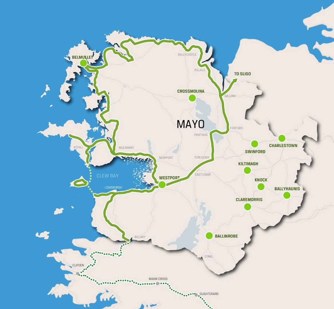
Map 6.1 Proposed County Greenway Plan – Linear long distance and Town Greenway Network
Pedestrian and Cyclist Policies |
|
|
MTP 6 |
To support safer cycling/walking routes to encourage people to be more physically active for transport and leisure purposes. |
|
MTP 7 |
To promote the design and construction of new developments to create low carbon, walkable neighbourhoods and workplaces containing high quality green and blue infrastructure. |
Pedestrian and Cyclist Objectives |
|
|
MTO 5
|
To encourage and facilitate the maintenance and further development of the public footpath network, walking and cycling routes and associated infrastructure and where possible the retrofitting of cycle and pedestrian routes into the existing urban road network. |
|
MTO 6 |
To support the establishment of a network of interlinked cycle ways and walk ways in the county and the adjoining counties, having regard to best practice standards including the Design Manual for Urban Roads and Streets and the NTA Cycle Manual or any amending/superseding national guidance or manuals. |
|
MTO 7 |
To endeavour to identify, preserve and enhance existing accesses and public rights of way to recreational areas including the coast, upland areas, lakeshores, river‐bank areas and heritage sites over the lifetime of the plan, subject to any forthcoming departmental guidance. |
|
MTO 8 |
To encourage, where appropriate, the incorporation of safe and efficient cycleways, accessible footpaths and pedestrian routes into the design schemes for town centres/neighbourhood centres, residential, educational, employment, recreational developments and other uses, with the design informed by published design manuals, including the Design Manual for Urban Roads and Streets and the NTA Cycle Manual or any amending/superseding national guidance or manuals. |
|
MTO 9 |
To continue the development of a network of Greenways in the county in accordance with best practice and where it can be demonstrated that the development will not have significant adverse effects on the environment including the integrity of the Natura 2000 network. |
|
MTO 10 |
To investigate the potential of providing looped Greenways / Walkways for the Tier I, II and III Settlements of the county, where it can be demonstrated that such schemes will not have a significant adverse effect on the environment including the integrity of the Natura 2000 network. |
|
MTO 11 |
To investigate the potential of providing a number of ‘Park and Stride’ facilities in appropriate locations in the county, subject to an environmental assessment of identified locations. |
|
MTO 12 |
To seek to advance the walking/ cycling projects listed in the table 6.4 below. |
|
MTO 13 |
Protect open spaces, with multifunctional green and blue infrastructure in developments, with connections to the wider network of open spaces and habitats |
Walking and Cycling Projects |
|
CLEWBAY GREENWAY WPORT/LBURGH/ROONAGH/CLARE ISLAND/KILLARY |
|
CLEWBAY GREENWAY ACHILL SOUND / KEEL |
|
CLEWBAY GREENWAY ACHILL SOUND / CLOUGHMORE |
|
CASTLEBAR URBAN GREENWAY LINK PHASE 1 & PHASE 2 |
|
TRAILS DEVELOPMENT |
|
GWG IMPROVEMENTS, IMPROVED TOWN LINKAGES INCLUDING NEWPORT TUNNELS |
|
BANGOR TRAIL & ERRIS ADVENTURE BRIDGE |
|
TURLOUGH/PONTOON/FOXFORD (INCLUDING RIVERSIDE TRAIL AT TURLOUGH RIVER FALLS) |
|
IMPROVEMENTS TO TOCHAR PADRAIG |
|
BOWERS WALK BALLINROBE |
|
MONASTERIES ON THE MOY/ATLANTIC CYCLE NETWORK |
|
WESTPORT CONG LOST TREASURES TRAIL |
|
MOUNTAIN BIKE CENTRE AND MAYO/SLIGO BIJE TRAIL |
|
MOOREHALL MASTERPLAN (INCLUDING TRAILS) |
|
SLIEVEMORE TRAIL |
|
IMPROVEMENTS TO WESTERN WAY |
|
SPIRITUAL TRAIL (CROAGH PATRICK, CONG AND KNOCK) |
|
LONG DISTANCE COASTAL GREENWAY (MAP 6.1) |
|
LONG DISTANCE INTERURBAN GREENWAY (MAP 6.1) |
|
TOWN GREENWAYS (MAP 6.1) |
|
NATIONAL COASTAL PATH, INCLUDING CÉIDE COAST |
|
IMPROVEMENTS TO KEEM BAY SIGNATURE DISCOVERY POINT, INCLUDING TRIAL AND VIEWING PLATFORM |
|
FALCON TRAIL FROM CANALSIDE BALLINA TO MOUNT FALCON ESTATE |
Table 6.4 – List of Walking and Cycling Projects
6.4.1.3 Bus
The development of a quality bus system as an alternative to private car use is an essential element of an integrated and balanced land use transport system. There is a need for increased bus services to improve connectivity between the main urban centres in the county and regional centres. The main settlements in the county are serviced by both public and private bus operators. Under the Rural Transport Initiative, the rural areas are served by Local Link Mayo, which is based on demand. The Local Link currently operates forty-six Demand Responsive Routes in Mayo, in addition to managing the ferry service to Inishbiggle Island. The Local Link co-ordinates the delivery of community transport services for the National Transport Authority with support from Mayo County Council and provides essential transport for rural based passengers, to access services and facilities in towns and villages. Seasonal bus services also operate to/from the National Park in Ballycroy and the Great Western Greenway from Westport. The further development of Local Link Mayo and other similar public transport services is essential to provide a modal shift to public transport in the rural parts of the county. Mayo County Council will work with public transport providers to improve and expand the public bus services within county and strengthen linkages to other areas outside of the county.
Bus Policies |
|
|
MTP 8
|
To support and encourage public transport providers and rural community transport initiatives and programmes, such as the Local Link Rural Transport Programme, to enhance to provision of public transportation services linking rural villages to the main towns of Mayo. |
Bus Objective |
|
|
MTO 14
|
To support the operation of existing bus services, by facilitating the provisions of improved facilities and services for bus users in towns and villages, including the provision of set down areas for coaches and bus shelters at all bus stops, where feasible. |
6.4.1.4 Rail
Iarnród Éireann in their strategic policy document “Rail Vision 2030: The Future of Rail Transport in Ireland” notes the importance of the Dublin-Westport/Ballina service and that demand at Castlebar is particularly strong. It confirms the important role of rail in servicing the interconnectivity between the key towns of Mayo. Mayo County Council supports an increase in the frequency of commuter services on mainline rail network between Westport, Castlebar and Ballina. The low frequency of current rail services in Mayo, renders rail travel an unviable transport option for daily commuters. Increased frequency of rail services and a greater integration of bus and rail services would provide for enhanced services and would facilitate the transfer from private car to bus and rail. Improving the frequency of train journeys on the Westport and Dublin line and the manning of train stations in Mayo would also attract increased usage of the rail service not only out of county but also promote an increase in the commuter service between the Mayo stations.
At present, rail links are on an east‐west axis focusing on Dublin. The disused part of the Western Rail Corridor (WRC), which runs through the east of the county, if re‐opened for passenger and freight transport, would provide a link to the economies of three major urban centres (Limerick, Galway and Sligo) by rail. It could provide an economic stimulus to the region, while also offering the inhabitants of the region a sustainable alterative to car travel. The re-opening of the WRC has the potential to provide the greatest transformational change both in terms of a shift towards a low-carbon society/economy but also at a regional level as a key enabler to strengthen the functionality of the AEC and capitalise of the enterprise and employment hub of the Strategic Development Zone (SDZ) at Ireland West Airport Knock (IWAK).
Rail Policies |
|
|
MTP 9
|
To support the enhancement of rail services to Dublin and commuter services between Ballina, Castlebar, Westport and Claremorris with connectivity to Galway and Limerick Metropolitan Cities and major international ports such as Shannon / Foynes with the realisation of re-opening the Western Rail Corridor |
|
MTP 10
|
To support the re-opening of the Western Rail Corridor in order to deliver the Tuam – Claremorris – Sligo Rail at an appropriate level of service and at a standard capable of facilitating passenger and freight transport and present an opportunity to provide an integrated rail linkage to the Ireland West Airport Knock and its Strategic Development Zone. |
|
MTP 11
|
To support and encourage the provision of a high quality rail network and service (including commuter services) and ancillary works for passenger and freight carriage to, from and within the county, where it can be demonstrated that the development will not have significant adverse effects on the environment including the integrity of the Natura 2000 network. |
Rail Objectives |
|
|
MTO 15
|
To liaise with and encourage Iarnród Éireann to:
|
|
MTO 16
|
To support and encourage the upgrading of existing railway stations, and protect, as required, lands necessary for the upgrading of existing railway lines or stations. |
|
MTO 17
|
To work with the National Transport Authority & Iarnród Éireann to safeguard and protect all existing or historic rail lines and associated facilities from redevelopment for non-transport related purposes, in order to not preclude their future use as an operational transportation network. |
|
MTO 18
|
Support and facilitate the velo rail project on the Western Rail Corridor as an interim use for the rail line pending its reopening for passenger and rail freight. |
6.4.2 Roads (National & Non-National Roads)
Mayo County Council is committed to the promotion of sustainable means of travel, and the encouragement of modal change from the private car. It is, however, recognised that road infrastructure retains a central position in the overall transportation network, catering for the movement of buses, goods vehicles, pedestrians, cyclists, as well as the private car. In undertaking transport policies, the Council will strive to provide, maintain and enhance road infrastructure to ensure the sustainable economic development of the county.
6.4.2.1 National Routes
Mayo County Council recognises the strategic importance of the national road network in the county and its important regional and inter-regional connectivity within and through the region. The N5 and N17, national primary roads have been identified as part of the Trans-European Transport Networks (TEN-T). The TEN-T are a planned set of transport networks across Europe targeted for high-quality standards for road users and freight transport. The Council will preserve corridor(s) to enable design options for national road improvement and upgrade projects to be advanced. Table 6.5 provides a list of planned and proposed national road projects in County Mayo to be advanced over the plan period.
Significant investment and improvements in the existing road infrastructure have been made by the Local Authority, in terms of upgrades, realignments, maintenance, traffic management measures, traffic calming measures and road safety measures. It is important to protect, maintain and enhance the carrying capacity of the national road network in County Mayo, as deemed necessary and as resources allow. In doing so, due regard will be afforded to the Spatial Planning and National Roads Guidelines for Planning Authorities 2012, relating to development affecting national primary and secondary roads, including motorways and associated junctions.
National Roads Policies |
|
|
MTP 12 |
To enhance regional accessibility between key urban centres of population and their regions through the protection of the capacity, efficiency and safety of the national road network in County Mayo. |
|
MTP 13 |
To support the upgrading to a ‘High Quality Road’ of both the N5 and N17 National Primary Routes, within the county, as part of the Tran-European Transport Network (TEN-T). |
|
MTP 14 |
To support Transport Infrastructure Ireland in the provision of service and rest area facilities that may be proposed by the TII, and have regard to the provisions of Section 2.8 of the DoECLG Spatial Planning and National Roads Guidelines and the NRA Service Policy (August 2014), with regard to any other proposals for roadside service facilities or off-line service facilities along national roads and junctions that may be promoted by private developers. |
|
MTP 15 |
To protect the capacity, efficiency and safety of the national road network in Mayo by complying with the ‘Spatial Planning and National Roads -Guidelines for planning authorities’ (2012). |
|
MTP 16 |
To avoid the creation of any additional access points from new development or the generation of increased traffic from existing accesses to national roads to which speed limits greater than 60 km/h apply. |
|
MTP 17 |
In relation to sections of national roads on the approaches to or exit from urban centres that are subject to a speed limit of 60 kph before a lower 50 kph limit is encountered – otherwise known as transitional zones - provide for a limited level of direct access to facilitate orderly urban development. Any such proposal must, however, be subject to a road safety audit carried out in accordance with the TII requirements and a proliferation of such entrances, which would lead to a diminution in the role of such zones, must be avoided. |
National Roads Objectives |
|
|
MTO 19 |
To apply a less restrictive approach to non-residential development of strategic or national importance or extensions to such developments accessing onto the National Road Network in accordance with the provisions of Section 2.6 of the ‘Spatial Planning and National Roads -Guidelines for planning authorities’ (2012). |
|
MTO 20 |
To ensure that developments which have the potential to generate significant traffic movements, as per the TII traffic and transportation guidelines which will be required to carry out the assessments set out 7.5 of the Development Management (Volume 2). |
|
MTO 21 |
To seek to progress the National Road projects, listed in Table 6.5 subject, to required environmental assessments. |
6.4.2.2 Non-National Roads
Regional and local roads provide an important economic role and have a valuable social and community function. These roads account for 81% of the country’s roads and are often the sole means of access for local economic activity. Mayo County Council has the responsibility to maintain non-national roads and this maintenance programme is financed from the Council’s own resources and/or supplemented by state grants.
Local authorities, as outlined in ‘Investing in our Transport Future – A Strategic Investment Framework (DTTAS, 2015)’, are required to define a ‘strategic road network of national, regional and strategically important local roads’ and identify funding targeted in these areas. There is an increased emphasis nationally on project appraisal requirements which identify and prioritise upgrades that make the most appropriate use of available funding. There are eighteen ‘Strategic Regional Important Roads’ in County Mayo, linking the main settlements to the national routes. These are shown in Table 6.6 below.
Non-National Roads Policies |
|
|
MTP 18 |
To enhance regional accessibility between key settlements in County Mayo and their regions and to safeguard existing and future capital investment through the protection of the capacity, efficiency and safety of Strategically Important Regional Roads (Table 6.6). |
|
MTP 19 |
The Council, in co‐operation with the NTA, TII, Department of Transport, Tourism and Sport and other stakeholders, will continue with the strengthening and improvement of the local road network including links, by‐passes and relief roads, with priority given to those serving the Key Towns and interconnection between such settlements, where it can be demonstrated that the development will not have significant adverse effects on the environment or Natura 2000 network. |
|
MTP 20 |
It is an objective of Mayo County Council, in relation to lands adjoining Strategically Important Regional Roads to which to which speed limits greater than 60 km/h apply, to avoid the creation of any additional access points from new development or the generation of increased traffic from existing accesses to Strategically Important Regional Roads, unless it can be demonstrated that the development is required for economic or social reasons and cannot be accessed from a non-Strategically Important Regional Road. |
|
MTP 21 |
To implement the recommendations of the Design Manual for Urban Roads and Streets (DMURS) in relation to urban streets and roads within the 50/60 kph zone. |
Non-National Roads Objectives |
|
|
MTO 23 |
To improve and maintain regional and county roads in line with the annual roads programme and allocated budgets. |
|
MTO 24 |
To liaise with the TII and DTTAS regarding the revision of speed limits in the County. |
|
MTO 25 |
To facilitate the continued improvement and upgrading of all roads, should their status be re-graded, under the national roads programme and/or the Council’s road programme. The Council will seek and support the upgrading of the status of regional roads in the county which perform functions akin to national secondary routes. |
|
MTO 26 |
To promote and facilitate road safety measures throughout the County, including traffic calming, road signage and parking. |
|
MTO 27 |
To seek to progress the non-National Road projects, listed in Table No. 6.5 subject, to required environmental assessments. |
Road Projects in Co. Mayo |
|||
|
National Roads |
Regional & Local Roads |
||
|
Road Number |
Project Title |
Road Number |
Section |
|
N5/N26/N58 |
N5/N26/N58 Mount Falcon to Swinford, Castlebar East to Bohola Project incorporating the following:
|
R310 – R311
|
R310 Pontoon Road to the R311 Newport Road |
|
N5 |
N5 Turlough to Westport |
|
Killala Inner Relief Road (Phase 2)
|
|
N17 |
N17 Knock to Collooney |
R322 |
R322 Kilmaine to Foxhall |
|
N59 |
N59 Upgrades
|
R312
|
Glenisland |
|
N60
|
N60 upgrades:
|
R320 |
N17/R320 Junction at Lisduff |
|
N59/N26
|
N59/N26 Western bypass of Ballina (N26 Ballina bypass phase 1) |
|
Killala Strategic Link
|
|
N83 |
N83 Upgrade: N83 Bypass of Ballyhaunis |
|
Kiltimagh Strategic Link
|
|
N84 |
N84 upgrade: N84 Bypass of Ballinrobe |
|
Cong Relief Road |
|
|
Charlestown Strategic Link
|
|
|
TABLE 6.5 Road Projects in County Mayo
Road Classifications in Co. Mayo |
|||
|
National Roads |
Strategically Important Regional Roads |
||
|
Road Number |
Road Classification |
Road Number |
Section |
|
N5 |
National Primary Road |
R294 |
Ballina – Bunnycoonellan |
|
N17 |
National Primary Road |
R294 |
Bunnycoonellan – Sligo County Boundary |
|
N26 |
National Primary Road |
R310 |
Castlebar – Pontoon – Ballina |
|
N58 |
National Secondary Road |
R311 |
Castlebar - Newport |
|
N59 |
National Secondary Road |
R312 |
Castlebar – Bellacorrick |
|
N60 |
National Secondary Road |
R313 |
Bangor Erris – Belmullet |
|
N83 |
National Secondary Road |
R314 |
Ballina – Killala |
|
N84 |
National Secondary Road |
R319 |
Mulranny – Achill Sound |
|
|
|
R321 |
Ballylahan-Kiltmagh |
|
|
|
R323 |
Kiltimagh – Knock – Ballyhaunis |
|
|
|
R327 R330 |
Claremorris – Roscommon County Boundary at Cloonfad |
|
|
|
R330 |
Westport - Partry |
|
|
|
R331 |
Ballinrobe – Claremorris |
|
|
|
R332 |
Kilmaine-Galway-County Boundary |
|
|
|
R334 |
Ballinrobe – Galway County Boundary |
|
|
|
R335 |
Westport – Louisburgh |
|
|
|
R345 |
The Neale-Cong-Galway County Boundary. |
|
|
|
R346 |
Cross to Cong |
Table 6.6 National and Strategically Important Regional Roads in Co. Mayo
6.4.3 Air Transport
Ireland West Airport Knock (IWAK) is the principal international gateway into the region. IWAK is of major national, regional and local importance and provides international connectivity not only for the promotion of economic development in the county, but also to the economy of the wider region. The connectivity provided by the presence of an airport within the county, significantly broadens the region’s transport network capacity, providing catalytic direct, in-direct and induced economic and social benefits. The SDZ at IWAK came into effect in October 2019 and will help secure the long-term development of the airport as a strategically importance hub for transport, tourism, business and employment in County Mayo and the wider region. The SDZ has the real potential to be a key driver of the AEC in the region, helping to increase its potential to function as a cohesive model for balanced, regional, economic development.
Air Transport Policy |
|
|
MTP 22
|
To support the development of Ireland West Airport Knock as a strategic driver of economic development in the area and as a vital asset in maintaining and enhancing the connectivity of the region. |
Air Transport Objectives |
|
MTO 28 |
To safeguard public safety in the area around Ireland West Airport Knock by ensuring all development within 15km of Ireland West Airport Knock is subject to safe-guarding restrictions outlined in the Development Guidance document of this Plan. |
MTO 29 |
To ensure any development associated with light aircraft/helicopter activity is approximately located in areas that avoid significant adverse effects on the environment, the integrity of the Natura 200 network and residential amenity. |
6.4.4 Piers, Harbours and Landing Places
County Mayo has the longest coastline in Ireland (1,168 km). This marine resource has allowed the fishing sector to thrive, is of major importance to tourism and leisure activities, and is a fundamental part of our natural and cultural heritage. The Marine Section of Mayo County Council is responsible for marine infrastructure development, which is an essential component for the development of the aquaculture, commercial fishing, marine leisure and offshore energy industries.
The county has a strong fishing and aquaculture sectors providing considerable local employment both onshore and offshore for coastal communities. The Council will continue to support the more traditional marine activities, such as fishing, aquaculture and leisure, in terms of investment and infrastructure, in order to build vibrant, sustainable, coastal communities. In order to capitalise on the emerging blue economy sectors, such as offshore energy, the Council will explore the feasibility of the provision of a deep harbour at Kilcummin, with a view to facilitating appropriate offshore energy projects. Mayo’s pier, harbours and landing places must also be assessed for their suitability to accommodate landside infrastructure arising from offshore renewable energy projects.
Ports, Harbours and Piers Policy |
|
|
MTP 23
|
To support the development and improvements of ports, harbours, piers, slipways, associated shore facilities and access, where appropriate, where it can be demonstrated that the development aligns with the marine spatial plan and will not have significant adverse effects on the environment, including the integrity of the Natura 2000 network. |
Ports, Harbours and Piers Objectives |
|
|
MTO 30
|
To investigate the feasibility of creating a deep-sea harbour/port at Kilcummin, or other suitable coastal locations along Mayo’s coastal zone, to support offshore renewable energy projects. |
|
MTO 31 |
To seek to facilitate the implementation of the Marine infrastructural projects listed in Table 6.7. |
Ports, Harbours & Piers Projects |
|
|
|
|
|
|
|
|
|
|
|
Table 6.7 – Marine Infrastructural Projects
Contents
Observations
Observations
West on Track's submission to the Draft Mayo County Development Plan 2021-2027
West on Track welcomes the opportunity to make a submission regarding the County Development Plan 2021-2027.
West on Track is a community-based campaign advocating for the full restoration...
Western Rail Corridor Greenway
Mayo County Plan 2021/27 (MCP) submission hereafter Mayo County Council = MCC I wish to make a postal submission on the MCP. Please act on points below and any others overleaf and acknowledge this...
Western Rail Corridor Greenway
Mayo County Plan 2021/27 (MCP) submission hereafter Mayo County Council = MCC I wish to make a postal submission on the MCP. Please act on points below and any others overleaf and acknowledge this...
Western Rail Corridor Greenway
Mayo County Plan 2021/27 (MCP) submission hereafter Mayo County Council = MCC I wish to make a postal submission on the MCP. Please act on points below and any others overleaf and acknowledge this...